Affiliate Link Generator Copied!

|
1.415.462.1982

v4.6x CinemaPlugins DEM Earth

EDIT in Admin Edit in WP

Add to Wishlist

CinemaPlugins DEM Earth
  

Generate Digital Elevation Models

Easily generate dynamic Digital Elevation Models (DEM) and georeference them in real-time to your world imagery to create landscapes in real-time, with CinemaPlugins DEM Earth.  DEM Earth automatically downloads the data it needs to build the model you want. To clarify, all you have to do is provide a geographic coordinate. Produce real-time interactive and dynamic landscapes! Pan, zoom, animate and place anything in any way you want.

What’s new in DEM Earth

  • Geo Modifier –  Map any polygon, spline or point based object onto DEM Earth.
  • Track Graph  –  Make an instant graph out of a gpx track, or any spline.
  • Poly Importer – Import country, county, regional borders using the osmosis poly format.
  • Smart Extruder – vastly improved. Better caps, better UVW mapping, less polygons.
  • Smart OSM – New Interpolation and surface offset settings, deliver what you need.
  • DEM Earth Object – improved UVW, to make baking, much easier.

DEM Earth includes:

  • DEM Earth Generator – A realtime landscape generator which automatically downloads and caches DEM height data for you, for most parts of the world..
  • Smart OSM Object –  Easily download and manage OpenStreetmap data directly in DEM Earth.  More..
  • Smart Extruder Object –  A fast, intelligent building extruder, which works tightly with OSM Object and DEM Earth to produce great results. More..
  • PinPoint Object – Used for placing any 3D object on DEM Earth landscape with the ability to dynamically scale and move with the landscape
  • Way Object – A flexible spline Generator for Visualizing paths between objects on the landscape
  • Coverage Command – Visualize what DEM files you have already cached
  • GeoPointConverter – together with the Tools4D OpenStreetMap importer, easily overlay massive OSM data sets onto DEM Earth
  • GPX Importer – Easily import Tracks, Routes and Waypoints. Drag and drop your gpx file into C4D, DEM Earth does the rest.
  • World File Import – drag and drop industry standard World files into C4D and DEM Earth will create the landscape for you and overlay your image automatically
  • ASC height Import – Embed super high res height, commercial DEM or DSM data, directly into DEM Earth, using industry-standard ASC format (*Esri Grid, WGS84 geographic )
  • Direct ASC import – included. It is the only way to get a super accurate, non-interpolated, high res landscape data into Cinema4D. This is how easy importing DEM data should be.
  • Quickstart guide – Included
  • Automatic 90m Dem data downloader – Included
  • Automatic 30m DEM Data downloader – Included
  • DEM Earth Image Downloader – Included.  Easily capture web-based images from a multitude of open sources, with unparalleled ease. Access up to 22 different image map layers, or use your own imagery, or shaders.
  • GeoCoding Tool – included.  Both coding and inverse coding to get coordinates from names, and names from coordinates.

R20 or greater

  •  Poly Object : Openstreetmap Administrative borders for the entire planet. Hundreds of thousands of Polygon borders at your fingertips with this incredibly easy-to-use and very powerful new feature. For R20 or greater.
  • Image Loader –  up to 100x faster thanks to the new multi-threaded downloader.
  • Height data – New super fast height data content delivery no matter where you are, thanks to Cloudfront.
  • Smart OSM – New powerful Query engine.

FAQ

Q: What do I need to use DEM Earth?

  • Cinema 4D
  • OSX or Windows 64 bit only
  • an Internet connection.

Q: Does DEM Earth download DEM Data for me?

A: Yes! DEM Earth automatically downloads 30m meter and/or 90m data, as, and when you need it.

Q: Do I have to keep downloading data?

A: Initially, yes. But each tile(file) is downloaded and cached locally. So the next time you use this tile it is read from the local cache.

Q: Can I bake out my landscape?

A: Yes , you can easily convert your model to a standard polygon object.

Q: Is there any license for imagery ?

A: Any imagery accessed through this software, is always copyright of the respective owner. We are not in any position, to sell, transfer, or provide any license for imagery. CinemaPlugins.com makes no claim of ownership or license.

Q: What’s with the one year support?

A: You get one year support and service. Support is assistance for your account, from us. Service is access to our servers.

Q: Does the plugin still work if my support has expired?

A: Yes. You can still use the plugin. you can create new scenes, and use old ones. You do not have to renew your support, or buy the plugin again. However if you need our support, you clearly won’t get it, and your service is limited.

Q: How much does it cost to renew support?

A:  You can check the price of support renewal here..

License options FAQ

Standard License (node locked)

If you have a standard C4D license, the first 11 numbers from your serial will look like the following numbers:

14630012345

14500054321

The standard license option applies to a single, standard C4D license. This is for regular C4D installs, without a license server.

NOTE : The node locked license, locks to the first C4D serial you use it with.

Q : Can I get this number changed?

A :  No. Except if you upgrade your Cinema4D version to a higher version, and your support is up to date.

Q : Can I add seats to my existing accounts, to use the plugin on other workstations?

A :  YES. you can add seats to your existing DEM Earth account, here..

Standard Floating License

If you are not running over a License server, you can use this license to run a single DEM Earth license, on different workstations, using one account. 

A floating license is the same as a node locked license, but with the right to have the node lock changed. To change your node lock, please make a ticket request and include the 11 c4d license you want to have it changed to. A Floating license is not multiple licenses. it is still one license. if your need to run dem earth on multiple machines, it might make more sense simply to add seats to your account. A seat is a full node locked license for half the price of the main license. This is a cost effective way to use dem earth on multiple machines, via one account.

This is for regular C4D installs, without a license server.

License Server 

If you run Cinema 4D via a license server, you can read the number of licenses your server can issue from the first 11 numbers of your license.

e.g.

20600312345-xxxx-xxxx…………..  a 3 seat server license.

20601012345-xxxx-xxxx…………..   a 10 seat server license.

20600112345-xxxx-xxxx…………..   a single (1) seat server license.

If you need to have DEM Earth running on all the machines that your license server supports, you need to have a license for each machine. in this case. choose the License Server option, and add the number of licenses you need. There are significant discounts for multiple seats. you can also add one license and then add additional seats to the cart. for example, 1 standard license + 10 additional seats, costs much less than 11 full licenses.


Render Farms 

if you need to run DEM Earth on your render farm, please contact support for special pricing options.


* Volume discounts are automatically applied, starting at just 3 licenses.

Any questions? Contact us and we will do our best to help clear up any questions you may have.

Compatibility

  • MAC: Cinema 4D R20 – S26 (Please Note – MAC version is not compatible with v2023)
  • WINDOWS: Cinema 4D R20 to 2023
  • C4DLite (Cineware) is NOT supported.
  • Supports all render engines.
  • 64 bit only.

Node-locked vs. Floating Options

For floating licenses, you will need to buy the same number of licenses as your floating license permits. You can self-manage your node ID if you have a floating license.

The DEM Earth floating license option lets you de-register your node ID from prefs, and re-register it on another workstation, or with a different cinema4d license. You can do that yourself, from the prefs pane by simply pressing the Add/Remove Node ID button.

In R21+, you can manage your own Node ID by attaching and detaching it from your account. In R20 and below, you need to make a support ticket to get your node lock changed.

Requirements

  • An Intern8t connection.
  • At least 4 GB ram. (>16GB or more recommended)
  • C4D R16 or greater

View License Types (Pops)

Win

4.601 Sept 01 2022

Added a build for cinema 4D 2023

4.600 August 22 2022

  • DEM Earth Gradient- Refresh less 🙂
  • DEM Earth Gradient- Added Octane compatible gradient option. see in prefs/other stuff/octane compatible (for the default) then in your dem earth object, under gradient/Details there is an option to make the gradient octane compatible.
  • DEM Earth export – Fixed Height data export and grid layers which where locked to level zero.
  • DEM Earth Info – Fixed. Distance info for lon and lat where switched. oops.
  • DEM Earth Prefs – Cleanup.
  • DEM Cloner – Fixed an issue in with Poisson Disc distribution, which resulted in empty chunks.
  • DEM Earth – Added auto check for updates (see prefs) daily/weekly/monthly , etc.

4.595 July 15th 2022

  • DEM Earth – Found and fixed a critical bug which could result in flat data on reload of a scene.
  • DEM Earth – New default location. Glacier Peak.
  • DEM Earth – New default zoom is 4.
  • Gradients – Added “Mount Ain” as default gradient preset.
  • Gradients – Added Save (so you can save a preset) *.gradient Presets from the gradient folder are automatically loaded into the Type list.
  • Gradients – Added Copy/Paste.
  • Gradients – New icons for action buttons. The c4d icons I chose initially are completely different in previous versions of c4d.
  • Prefs – Added an option to set the default starting location (see prefs, under Various Settings / Other stuff) (more to come on this) It is a text field. i.e. Copy/paste a valid coordinate in here.

4.590 July 7th 2022

  • DEM Earth – Added new Layer – Global surface Water, up to level 13.
  • DEM Earth – Added Interpolation mode “Auto” which switches the interpolation to linear, if zoom is at 1.0 or less (calculates faster)
  • DEM Earth – Rewrote entire geographic sampling code (much better threaded and significantly faster)
  • DEM Earth – Rebuilt the default gradient with explicit colors at altitudes. See new gradient tab. WIP. Looking good 🙂
  • DEM Earth – Fixed several possible crashes, and a possible deadlock condition when saving.oops.
  • DEM Earth Server – You can now use either your email address or your account name to connect. The email must be unique to your account.
  • DEM Cloner – Fixed a crash with multiple child objects. oops.
  • Poly Object – Added option to check for outline parity. This ensures that an outline will always generate a surface with a normal which points upwards.i.e. if you extrude in leave auto on, it can go in the wrong direction, if this option is not activated.
  • Poly Object – Added an option to sample all points for height, take the max,or min, or most common height value. Useful for multi-polygon buildings, or water areas to avoid jagged vertical outlines.
  • Poly Object – Added an option to expand Poly Object to parent bounds. This creates an an image which fits the parent area, rather than the area of the polygon.
  • GeoReference tag – Added an invert option to embedding.
  • GeoReference tag – Now shows its image outline, if it is select. i.e. the DEM Earth object does not need to be selected. Selecting the tag shows the image bounds (in yellow)
  • GeoReference tag – Can now connect to Vector Pro 3. i.e. it sets the Image link, the size, axis, and position. Allowing you to extract vector data from an image layer..
  • GeoReference tag – Moved level setting to underneath capture button.

*Win and Mac Parity*

4.570 May 31st 2022

  • DEM Earth – fixed ASC and tiff loader crash with bi-cubic interpolation when embedding via data manager.
  • Poly Object – if Primary outline is activated, it now selects the largest outline inside the parent dem earth bounds.
  • Poly Object – if Primary outline is activated, alpha mask is now clipped to the parent dem earth bounds.
  • ASC/tiff/Outliner – fixed a bug which prevented embedded ASC or tiff height data from re-loading if an outliner object was in the stack.
  • DEM Earth – increased max subs to 6k
  • DEM Earth – Fit To Texture Icon was missing (to the right of the zoom slider)
  • DEM Earth Cloner – Added Color to instances and a color gradient range to dialog.
  • This is useful for creating basic tree shades, which is what this is for. Works great with Redshift.


4.565 May 12th 2022

  • DEM Earth – Cubic Interpolation fix for holes in data which can cause wild interpolation spikes.
  • GeoCoder – GoTo now Resets DEM Earth coordinate offsets to zero.
  • POLY Object – 1 level lower
  • DEM Earth – Fix for high request rate with missing data.
  • DEM Earth – Maintenance and improvements.
  • DEM Earth – Threading fine tuning.
  • DEM Earth – Changes to the default gradient.
  • DEM Earth – Further code cleanup and code reduction towards a new mac build!
  • GeoReference Tag – Added an option to load world file settings from a file.

4.500 April 26th 2022

  • DEM Earth Smart OSM – a multitude of server updates, due to osm servers going down, changing and other issues beyond my control.
  • DEM Earth Poly Object – server update and other solutions for various issues beyond my control.
  • DEM Earth Poly Object – fixed most of the UTF32 issues causing names to show as garbage names.
  • DEM Earth shaders – removed.
  • DEM Earth Project – Huge cleanup and maintenance getting ready for an m1 native build.

4.495 Sept 2021

  • DEM Earth  – Rebuilt for R25

4.493 Aug 14th 2021

  • DEM Earth  – Loading and refresh issues resolved.

4.491 Aug 3rd 2021

  • DEM Earth prefs – Additional information for license type and clearer explanations of what might be wrong if you fail to connect.
  • DEM Earth prefs – Download updates directly from prefs.
  • DEM Earth License – If there is a server problem or you lose your internet connection, the plugin will continue to work for up to 10 days without a connection to the DEM Earth license server.
  • DEM Earth Cloner – Faster. Various bugfixes and threading improvements. Works much better with larger areas.
    DEM Earth – Improved background loading response.
  • DEM Earth – Faster Sampling code makes everything even better!
  • DEM Earth Interpolation – improvements Various bug fixes.
  • DEM Earth Pin Point – Placement bug fix.

4.444 May 27th 2021

  • DEM Earth – a multitude of optimisations, improvements, and bug fixes
  • DEM Earth prefs – moved the Flush memory button out into the data manager. It now does what it was supposed to.

4.403 April 8th 2021

  • DEM Earth PinPoint Object – Bugfix
  • DEM Earth Cloner – Memory Leak fixed.
  • DEM Earth Cloner – Improvements

4.380 April 2nd 2021

  • DEM Earth HELP   – Links to helpdesk articles for Prefs, cloner, poly object, Route Object, Smart OSM Object. WIP.
  • DEM Earth Prefs  – Interface makeover.
  • DEM Earth Cloner – Added Distribution Modes – Random, Poisson, Grid, Hex
  • DEM Earth Cloner – Interface makeover.
  • DEM Earth Cloner – Fixed seed value, which was not properly used.
  • DEM Earth Cloner – Falloff Spacial bug fixed.
  • DEM Earth Cloner – Falloff now scales instances, rather than culling them. this is better for motion blur when the counts don’t want to be changing.
  • DEM Earth Cloner – Final Code Cleanup.

4.357 March 20th 2021

  • DEM Earth Cloner – Settings updated
  • DEM Earth Cloner – Added support for fields.
  • DEM Earth Cloner – now works with Octane. (via mg_cloner) for this to work, drop a mograph cloner before DEM cloner, and set the mg cloner to multi instances. It is then driven by DE cloner (zombie mode)
  • Image Downloader – ESRI links removed (for now) pending clarity.
  • Image Downloader – method updated to new downloader core. Slightly slower, but more reliable(less possibility of black tiles)
  • DEM Earth Cloner – initial refresh issue fixed.
  • DEM Earth Cloner – now inserts itself under an active DEM Earth object, if one is selected on creation.

4.302 March 10 2021

  • Data Downloader rewrite. Everything is now way better 🙂
  • Removed dead Image layers.
  • Added – DEM Earth cloner. A tree map for the entire planet.
  • Added – your account ID is now visible in prefs, to help you spot if there is mismatch.
  • More fixes and improvements than I dare to put into words.

4.155 December 20th 2020

  • added – dem earth scene cache. Loaded base height data is saved with the scene. this eliminates a lot of problems with reloading and unpacking data when a scenew is loaded back in. Your data is now instantly ready.
  • added – Tree image layer (up to level 12)
  • added – new filed to the georef tag, to insert shaders or images that you additionally want to have locked down to the dem earth surface.
  • changes – to the Structure object (this is still a never ending WIP)
  • Added – protective code to mitigate multiple installs. Since R20, it is now very easy to have the same plugin trying to load from multiple locations. Its sloppy, but it is how it is, and we have to deal with it. if multiple versions try to load, it will stop trying to load the plugin again, and print the name of the directory it was trying to load from to the console. The console output has been cleaned up.
  • Added – a color selection shader. Use this to select water(or whatever) by picking a color, and setting a tolerance. As good as it gets. This should bake well for other engines. this is a great goto shader, which should find applications for a lot of tasks that should be trivial, but are not.
  • Added – a normal shader setup button to the Georef tag.
  • Removed – the “data set” tab from the dem earth main object interface. Now found in the Data Manager.
    if you are using multiple dem earth objects, in a parent/child structure, only the parent has control. The controlling parent is now indicated by a blue bounding box.
  • Background loader – speedup, Stability, caching and performance improvements to the height data background loader.
  • OSM object – Details – Interpolation distance set to 100m by default. This ensures that there are enough points to match a surface.
  • Poly Object – Refresh, stability and performance improvements.
  • Geo Edge – New Point removal mode. Removes points by nbr angle. Just an experiment that is worth leaving in there. Maybe someone can make use of it.

4.100 November 3 2020

  • Added – smart Hide visibility setting directly to dem earth. this looks great in the viewport as it hides edges where the connecting polys have similar normals.
  • Added – Smart Slide function to the Geo Edge modifier (slice geometry along a water line)
  • Added – Smart Split function to the Geo Edge modifier.
  • fixed – lots of selection tags where being created on the dem earth object.
  • fixed – a small bug in smart OSM which caused random segments to appear, depending on the interpolation setting.
  • improved – outliner.
  • improved – embedding of tiffs is now at least 3 times faster and much more efficient using the new data manager.
  • removed – asc embed settings from dem earth object, and replaced them with a new data manager tool.
  • fixed – a nasty bug which could cause a freeze when selecting admin borders which would initiate height downloads.added new height data -for Iceland – SRTM 90m and 30m
  • added new height data – Iceland – SRTM 90m and 30m
  • added new height data – Scandinavian regions 60 to 71 degrees north – SRTM 90m and 30m (derived from EU-dem)
  • added new height data – Alaska 60 to 72 degrees north – SRTM 90 (derived from USGS_NED_2)

4.090 October 8th 2020

  • fixed – a crash bug on macs being caused by there being multiple versions of the plugin in the launch folder. Fully caused to the fact that cinema4d loads all versions into c4d. Before deciding which ones should be unloaded.
  • Added – Outline object (beta first show), for polygonizing lots of road splines, quickly. I will wait for user feedback on this.

4.080 October 5th 2020

  • Added -new object  – DEM Earth structures.
  • This is still being worked on, but it is worth adding at this point. This object can be used on any spline, but is meant to be used with Smart OSM, to add structure blocks, to roads, in remote areas, where no building outlines exist.
  • It’s fast, and also makes use of fields, so you can restrict where you want blocks to go.

4.073 September 29th 2020

  • Fixed – tweetmap and traffic volumes.
  • Added – 3 new “no label” image layers. Voyager,Positron and Dark Matter
  • Updated – Smart OSM. Massive speed, and functionality updates. Clipping,filtering and ordering, have vastly changed. You can now download a lot more with Smart OSM.
  • updated – Poly Object, to work better with smart OSM.
  • updated = smart extruder, to work better with smart OSM.
  • fixed – possible error saving masks on manually imported polys with multiple line endings after their name.

4.037 September 13th 2020

  • Added – Setting in prefs for Downloader resulting file format. currently TIFF,PNG, EXR. default is TIFF.
  • Changed – Clean up in prefs “various” options.
  • Changed – When you grab osm data with the OSM object, it no longer centers on the new data. Much better.
  • Added – Exporting height data now exports a world file ,as well as the info file.

4.036 September 9th 2020

  • Added – Reverse geocoding to the pinpoint object. press shift+mouse-down to move a pinpoint in the viewport. When you release the mouse the address is recalculated and the pin gets renamed, and given an annotation tag.
  • New – Geo Edge. An intelligent triangulation modifier.

Version 4.035 September 6th 2020 (WIN + MAC) for R20,R21, S22 , R23

  • Fixed – An issue causing random crashes with the new background downloader. A nasty one, but it seems to be sorted now.
  • Fixed – Some rounding errors with the new geocoder. i.e. if you put in Amsterdam, it would round it to longitude 4 instead of 4.9 and you would be miles off.
  • Added – a tiff loader. Exactly the same as the ASC loader, but a tiff takes up a lot let space, loads in instantly, and just better. it needs a world file to go with it. but if any of you use global mapper, this is a nice addition.
  • Added – geocoder can now bake uvw coords to flat projection for you, in realtime, so you don’t have to bake your textures for exporting.
  • Fix – ggle image layers on MAC

Version 4.031 Aug 20th 2020 (WIN + MAC) for R20,R21 and S22

  • Complete rebuild of the entire project, for unified and automated builds across R20,21,22 and beyond. This will speed up updates.
  • Complete rebuild of height data downloading methods. No more waiting for height data to load. New potential.
  • Complete rebuild of the geocoder.
  • A lot of changes in preparation for R23 and beyond.
  • more bug fixes.

Version 4.022 May 18, 2020 (WIN + MAC R21/S22)

  • Change all map layer URLs to https (from http)
  • Open Streetmap, no labels fixed (server address changed)
  • Google layers fixed.
  • added google terrain layer.
  • added a visual border to texture tags.
  • Updated Esri World layer to the newer Clarity layer (better quality)
  • Updated tile downloader. you should be able to increase the max threads now.
  • Fixed a bug/odd group/crash, in the prefs “cinemaplugins menu” top group.
  • Fixed a bug with strata on/off.
  • added an option in world settings to scale dem earth by the world scale factor.
  • embedding an image via the georef tag now automatically detects the height of the layer.
  • Clean up of extensions/dem earth, where you can also find the plugins(as well as in the top menu)
  • Fixed loads of other small bugs 🙂

added the ability to segment parts of dem earth, and cut them out into standalone objects.
This uses the georef tag to re-project the flat coordinates to uv space, in realtime. For this to work, you have to drop a specific texture tag, controlled by a georef tag, into the link slot, in the geomodifier. Probably needs a tut, but it is dead easy in the end(its magic).

Version 4.013 Feb 19th 2020 (Windows + Mac R21)

  • Fixed a bug which effected the help system.
  • Fixed a bug limiting the size of dem earth via handle.
  • Fixed a bug in poly object preventing names in different languages from being read correctly.
  • fixed several small bugs.
  • fixed ASC direct loading where normals where inverted.
  • improved ASC loader. Huge speedup (up to 10x)
  • general speedup. several parts of the pipeline are now multi threaded. (i.e. geo-modifier)
  • Added dem earth plugins to extensions menu as well as standard and default layouts.
  • height data export. new modes.
    • 32 bit, single channel tiff. These values contain the c4d values in c4d space, as is.
    • 32 bit, normalized, single channel exr. Contains the normalized range values (0.0->1.0) remapped between min/max c4d height values.
    • 16 bit, normalized, single channel png. Contains the normalized range values (0.0->1.0) remapped between min/max c4d height values.
    • an .info file is also exported, to give you some idea of whats in the file.
    • the height file now gets an informative unique name.
    • the export is multi-threaded,and is several times faster than the initial effort.
  • Added new DEM Earth shaders. These shaders work with Cinema4D engines as well as Corona.
    • Contours (adaptive contour lines which do not distort and scale with dem earth zoom)
    • Simple Slope (a nice, easy to use, slope shader)
    • Valley fog (a nice simple fog shader ! )

v4.005, January 2020 (R21)

Adds Compatibility with R21


  • 4 new height data sets
  • CloudFront height content delivery
  • New Route Object.
  • Poly Object – new multipolygon query (for finding lakes, rivers and a lot more)(see lake image)
  • Smart extruder – big improvements, for better results.
  • GeoCoder  rewrite. Now uses mapbox api for better results.
  • rebuilt licensing and self managed floating license option.
  • GeoRef Tag – Embedding functionality rebuilt(see lake image)
  • Complete new rebuild for R21
  • many other bugfixes and improvements.
    • in R21 there are no 11 numbers, so I have had to adapt my licensing to suit the new system.
      The new version comes with 2 licenses options.
      1.Node locked.
      2.Floating.
      there is no license server option anymore.

v3.6.3 and 3.12, June 2019 (R20 and earlier versions)

The updates are v3.63 for Cinema R20 and v3.12 for pre-R20.

This is a free update for any license purchased during or since September 2018

This is a free update if you have paid for a DEM Earth for R20. In all other cases, you need to upgrade your DEM Earth license to the R20 version. Your support needs to be up-to-date to get your node lock changed to your R20 number.


v3.32, April 2019  (R20 Mac + Win)

  • Added – Some useful info to the downloader tab (Tile count, image size etc.)
  • Complete rebuild – of the MACOS version. This was an absolute nightmare.
  • Changed – DEM Earth prefs are now grouped under CinemaPlugins..com prefs.
  • Fixed – Several OSM importer bugs..
  • Fixed – OSM bug causing strange lines. this was due to me using UInt32  instead of Int64 for node id’s
  • Fixed – Drag drop ASC import was being clipped.
  • Added – 32bit tiff single channel height map export from the image loader. This lets you export the height map for use as displacement.
  • Fixed – Bug where the setting for image preview size was ignored.
  • Changed – Welded image output to tiff format. this dramatically improves load and preview refresh time.
  • Faster  – Tile welding pass
  • Added – Threaded texture downloader. up to 100x faster downloads depending on your CPU and bandwidth.

Version 3.22 Sept 18th 2018

  • Fixed- OSM server not responding specifically on MAC, in R20.

Version 3.20 Sept 1st 2018

  • Adds CINEMA 4D R20 Compatibility
  • Fixed- OSM server not responding sometimes

Version 3.12 Aug 21st 2017

  • Fixed – a problem stopping ASC files from loading.
  • Added – another layer to the new  map layer list.
  • Added – new function in georeference tag, that lets you embed/displace with textures.

Version 3.1 Aug 16th 2017

  • Fixed – a problem stopping DEM Earth from working fully with C4D R19.
  • Fixed – missing UV Coordinates, making baking textures a bit strange.
  • Fixed – missing Map Tile Servers.
  • Added – new map tile servers.
  • Fixed – various bugs and changes.

Version 3.08 Nov 18th 2015

  • Fixed- a problem preventing old scenes loading with 3.07, if they contained embedded height data
  • Improved  – increased the maximum area of a GPX track to 1000km

Version 3.07 Nov 17th 2015

  •  Changed – prefs password is now masked after entry
  •  Added – prefs option “Center After Embed” decide if DEM earth should center on your embed data, when you add it.
  •  Added – custom server to prefs.Use your image server with DEM Earth.
  •  Fixed – some issues with gradient refresh.
  •  Improved – gradient height values can now go below zero (needed for bathemetry)
  •  Improved – Massive speed up with DEM Earth tile extraction.
  •  Fixed – multiple minor issues.

Version 3.01 Oct 7th 2015

  • SMART OSM –  new setting “Levels” imports building levels, where available, and reflects this in the extruder.
  • SMART OSM –  finds more height values.
  • SMART Extruder–  got a new “Levels” setting.
  • SMART Extruder– Status update bar.
  • Several bug fixes and improvements.

Version 3.00 Sept 10th 2015

  • New – Geo Modifier –  Map any polygon, spline or point based object onto DEM Earth.
  • New –  Track Graph  –  Make an instant graph out of a GPX track, or any spline.
  • New – Poly Importer – Import country, county, regional borders using the osmosis poly format.
  • Improved – Smart Extruder – vastly improved. Better caps, better UVW mapping, less polygons.
  • Improved – Smart OSM – New Interpolation and surface offset settings, deliver what you need.
  • Improved – DEM Earth Object – improved UVW, to make baking, much easier.
  • Lots – of minor bug fixes and improvements

DEM Earth Beginner's Guide

Jonathan Winbush has a fantastic overview for DEM Earth, a plugin from CinemaPlugins that works in Maxon Cinema 4D.

More...

Clean 3D Animated Travel Map Tutorial in After Effects

In this tutorial, Ignace Aleya shows you how to create a travel scene in After Effects. He animates the travel map of Europe from Belgium to Moscow.

More...

Create Animated Routes in DEM Earth for Cinema 4D

Jonathan Winbush explains how to make accurate animated custom routes in DEM Earth and Cinema 4D. This technique has many uses for animated maps.

More...

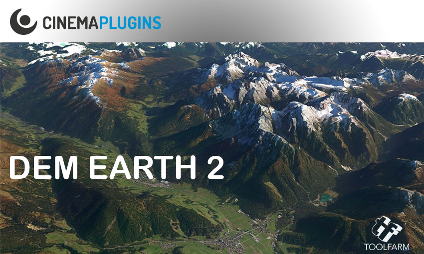
CinemaPlugins DEM Earth Overview Tutorial #gettingstarted

DEM Earth allows users to easily generate dynamic Digital Elevation Models and geo-reference them in real-time to your world imagery. CinemaPlugins has released a new point update to this week that adds improves and adds new features and fixes a few issues. All owners of v2 are advised to update.

More...


California Consumer Privacy Act (CCPA) Opt-Out IconYour Privacy Choices Notice at Collection